


ISO-Traceable calibration
Certified precision standards
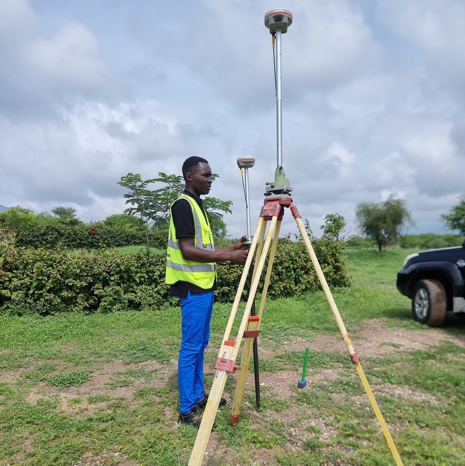
EasT africa coverage
Nationwide field operations
Fast turnaround
Same-day to 5-day service
24/7 Technical support
Always available for you
East Africa’s most trusted
geospatial Technology
partner
Founded and headquartered in Nairobi, Kenya, Epichtech Technologies Limited has spent over 3 years at the forefront of precision geospatial technology in East Africa. We are a full-service geospatial solutions company – combining world-class equipment supply, ISO-traceable calibration, expert field repair, and KCAA-licensed UAV aerial operations under one roof.
Our clients include individual land surveyors, civil engineering firms, government ministries, international NGOs, large-scale agricultural enterprises, and infrastructure developers – all united by a single requirement:
accurate, reliable and professionally delivered geospatial data and instrumentation
they can stake their projects on.
As authorized dealers and service centers for Kolida, Bosch Professional, Garmin, DJI, FOIF and Emlid,
we provide geniune parts, manufacturer-certified repairs, and the most current firmware – backed by our own team of over 15 certified engineers and geospatial specialists with deep field experience across Kenya and the wider
East Africa region.
AUTHORISED DEALER & SERVICE CENTER FOR LEADING GLOBAL BRANDS
KOLIDA
BOSCH
GARMIN
DJI
FOIF
EMLID
equipment
Precision Survey Instruments
Services
Repair, Calibration & Training
Aerial solutions
UAV Mapping & Drone Operations
agriculture
Precision Farming & NDVI Mapping
Comprehensive Geospatial Services
From equipment sales and technical servicing to advanced aerial data collection, Epictech Technologies delivers end-to-end solutions for surveying and mapping professionals.
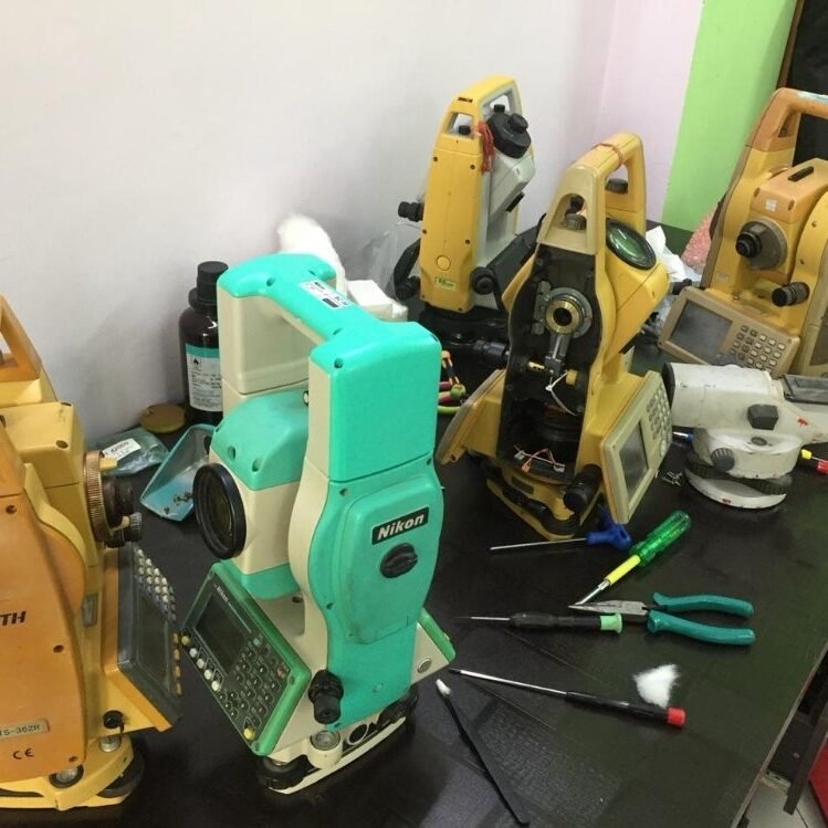
Repair & Maintenance
Expert repair and maintenance for total stations, GNSS receivers, levels and all geospatial instrumentation.
Calibration & Configuration
ISO-traceable instrument calibration and software configuration services ensuring your equipment meets required accuracy standards.
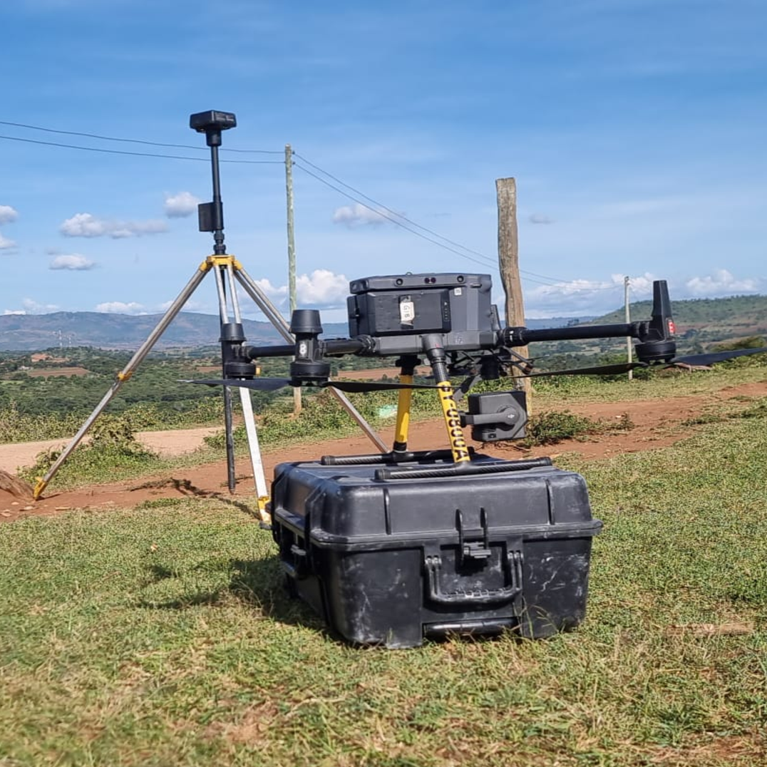
Aerial Mapping & Surveying
High-resolution UAV-based aerial mapping for topographic surveys, 3D modelling and orthophoto production.
Equipment Hiring
Flexible equipment rental solutions for surveying projects – short-termand long-term hire of total stations, GNSS units, drones and more.

Equipment Training
Hands-on technical training programs for surveyors, engineers, and GIS professionals on the latest equipment and software.

Precision Agriculture
UAV-driven crop monitoring, NDVI multispectral imaging, and precision agriculture analytics to boost productivity.
READY TO START
Get a Free Consultation & Custom Quotation Today
Your Trusted Geospatial Partner in East Africa
With deep technical expertise, state-of-the-art equipment, and a commitment to client success, Epictech Technologies stands apart as the region’s leading geospatial solutions company.
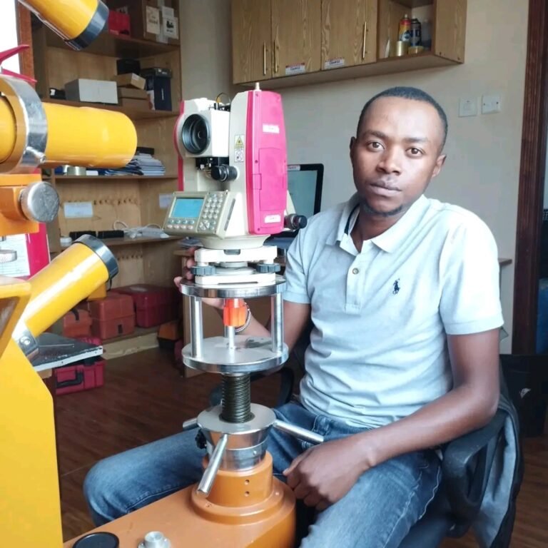
Certified technical team
Every member of our technical team is factory-trained and holds manufacturer certifications from Kolida, Bosch, Garmin, DJI, FOIF, and other leading OEMs. Our engineers undergo continuous professional development to stay current with the latest firmware, software updates, and field methodologies — ensuring you always receive expert guidance based on current best practice.
Fast turnaround times
In survey and construction, every day of equipment downtime costs money. Our workshop operates a streamlined express service process — from initial diagnosis and detailed quotation to certified repair, calibration, and quality inspection — designed to return your instruments to field-ready condition in the shortest possible time. Standard turnaround: 3–5 working days. Express service: 24–48 hours for critical instruments.
Proven track record
Since our founding, Epictech Technologies has built an unbroken track record of successfully delivering on client commitments — across land surveying, topographic mapping, construction control, infrastructure development, government mapping programmes, and precision agriculture. Our portfolio spans over 500 completed projects and 200+ satisfied clients across Kenya and East Africa, built entirely on repeat business and referrals. Our work speaks for itself.
dedicated after-sales support
At Epictech, the sale is only the beginning of our relationship. We provide comprehensive after-sales support including instrument commissioning and setup, operator training, software configuration, firmware updates, warranty management, and ongoing technical helpdesk support via phone and WhatsApp. Our clients never feel alone in the field — our technical team is always reachable when you need us most.
Competitive & transparent pricing
Best-in-market pricing with no hidden charges. We offer flexible payment terms and financing options for qualifying clients.
Nationwide field operations
Fully mobile service teams available to deploy to any location within Kenya and across East Africa for on-site support and fieldwork.