

Built on Precision,
Driven by Innovation
Epictech Technologies Limited was established in Nairobi, Kenya, with a clear and focused mission: to bridge the gap between complex geospatial challenges and precision technological solutions — and to make world-class survey equipment, technical expertise, and aerial data services accessible to professionals across East Africa.
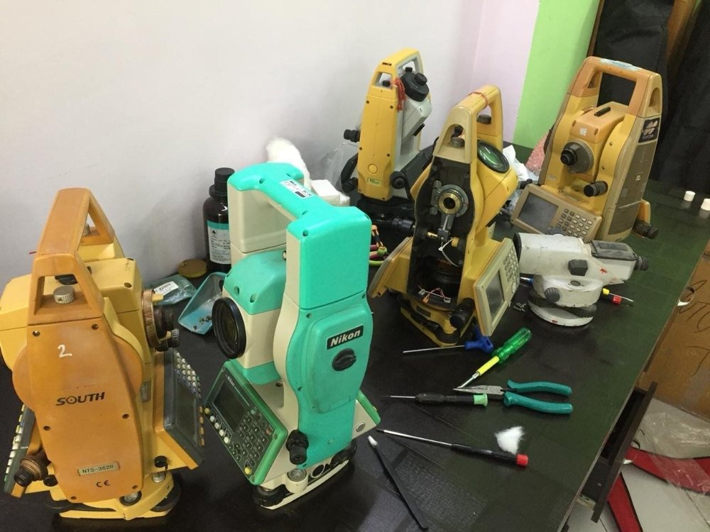
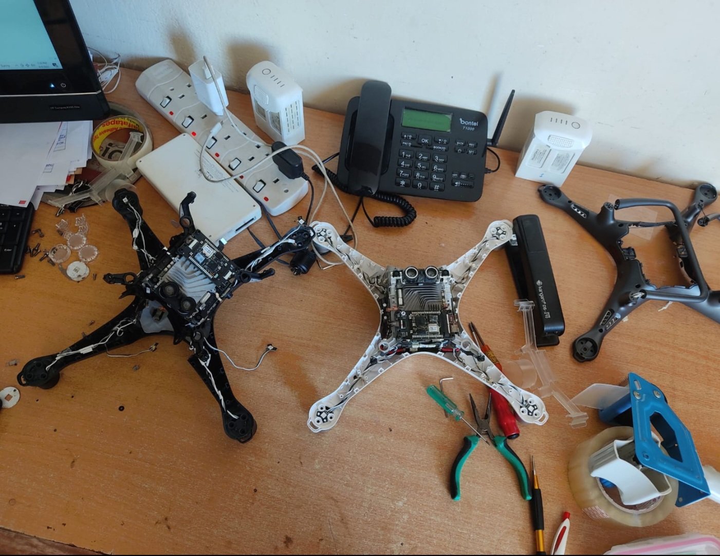
We began as a specialist supplier of high-end surveying instruments, building deep expertise in the equipment that land surveyors, engineers, and geospatial professionals rely on every day. Recognising that our clients needed more than just products, we rapidly expanded into comprehensive technical services — calibration, repair, training — and ultimately into advanced UAV aerial solutions that are reshaping how spatial data is collected across the region.
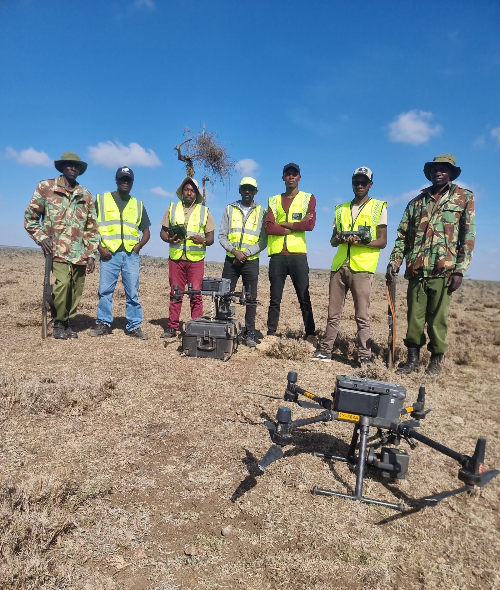
Today, Epictech Technologies is a full-service geospatial technology company headquartered off Kasarani Mwiki Road, Nairobi — serving clients from individual surveyors and construction firms to government ministries, NGOs, agricultural enterprises, and international infrastructure investors. We are an authorised dealer and service centre for leading global brands including Kolida, Bosch Professional, Garmin, DJI, FOIF, and Emlid.
Our team of over 15 certified engineers and geospatial specialists brings together expertise that spans land surveying, GNSS positioning, UAV operations, photogrammetry, GIS, and precision agriculture — giving our clients access to an unmatched depth of knowledge and a single trusted partner for all their geospatial needs.
Mission, Vision & Values
The principles that guide everything we do — from how we serve clients to how we develop our team and deliver results in the field.
Our mission
To empower land surveyors, civil engineers, government agencies, agricultural professionals, and infrastructure developers across East Africa with the most advanced precision geospatial technology, expert technical services, and reliable aerial data solutions — enabling smarter decisions, greater operational efficiency, and consistently outstanding results in the field. We achieve this by investing continuously in our people, our equipment, and our partnerships with the world’s leading instrument manufacturers.
our vision
To be the most trusted geospatial technology partner in Africa — renowned for technical excellence, continuous innovation in aerial and spatial data solutions, and an unwavering commitment to client success. We aspire to lead the development of precision geospatial infrastructure across the continent, equipping the next generation of African surveyors, engineers, and spatial data professionals with the knowledge, tools, and services they need to build a more accurately mapped, better understood, and more sustainably managed Africa.
our values
Precision in every deliverable. Integrity in every client engagement. Innovation in our solutions. Reliability in our service. Respect for the environment and communities we serve. These are not just words — they are our daily operating principles.
The Pillars of Our Culture
Every member of the Epictech team lives by these values in their daily work, ensuring a consistent, high-quality experience for every client.
Precision
We never compromise on accuracy. Every calibration, every dataset, every report meets the highest technical standards.
Integrity
Honest communication, transparent pricing, and ethical conduct form the foundation of every client relationship.
Innovation
We continuously invest in new technology and methodologies to keep our clients at the leading edge of geospatial practice.
Client Focus
Your project goals are our goals. We tailor every solution to your specific requirements, timelines, and budget.
Reliability
We deliver what we promise, when we promise it. Dependability is not an aspiration — it’s our standard operating procedure.
Excellence
We pursue excellence relentlessly — in our technical outputs, our customer service, and our internal processes.
Local Expertise
Deep knowledge of East African terrain, regulations, and client needs allows us to deliver solutions that truly fit the region.
Sustainability
We operate with environmental responsibility, promoting data-driven practices that support sustainable land use and conservation.
The Epictech Advantage
When you choose Epictech Technologies, you’re choosing a partner with proven expertise, industry-leading equipment, and a genuine commitment to your success.
Factory-Certified Engineers
Our technical team holds manufacturer certifications from Leica Geosystems, Trimble, Topcon, DJI, and other major OEMs.
Authorized Service Center
As an authorized service and calibration centre, we maintain all warranty integrity and use genuine parts for all repairs.
End-to-End Capabilities
From equipment supply and servicing to aerial data collection and GIS analysis — we handle the full geospatial workflow in-house.
Rapid Response Times
Equipment downtime is costly. Our 24-48 hour response policy and express service track minimize interruptions to your operations.
24/7 Client support
Our dedicated support line and WhatsApp helpdesk are available around the clock for critical technical assistance.
Transparent, Competitive Pricing
Detailed quotations with no hidden costs. Flexible payment options including installment plans for major equipment purchases.